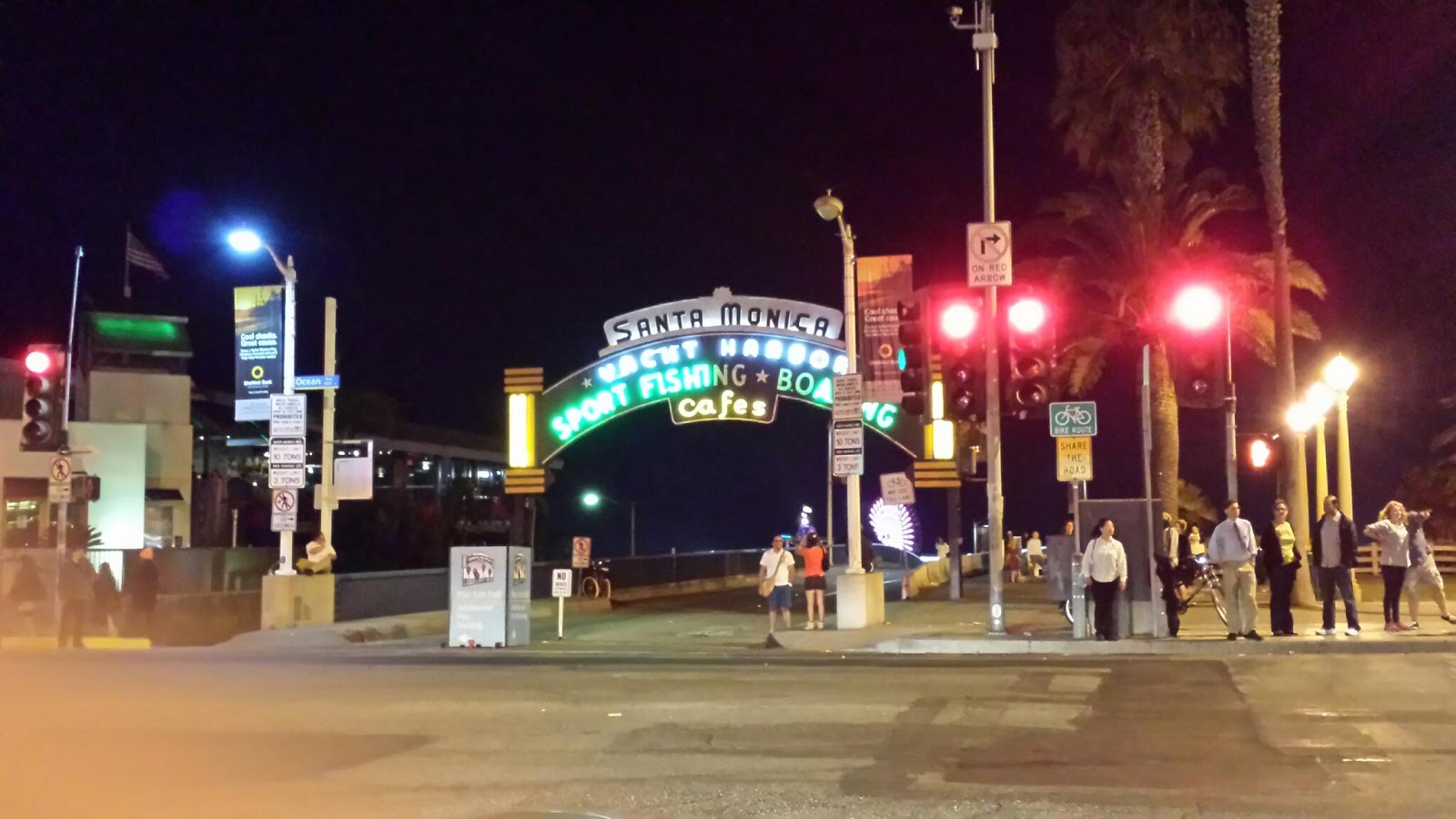
We finished Route 66 in grand style last night... with friends. The last leg of 66 had been rather uneventful, as much of it in CA is scattered about and crumbling, so we just kept on moving. We found the end of 66 to be the Santa Monica pier, alive and bristling from the energy of a free late-summer concert over the water. We had help getting across the finish line, of course. Waiting there to meet us there was Lynn, Deanna's friend whom she hasn't seen in 14 years. She remembers this because Lynn introduced us to her daughter Mattie, who is a 14- year-old version of herself. Time does fly, but getting together with an old friend can make it seem like nothing has changed but the date.
After another round of lasagna, laughs, and hugs, it was time to head north. We figured it would be a good idea to drive just an hour or two, getting us to Los Padres National Forest, where we could set up camp for the night and get an early start to the morning. We planned on driving just a few miles into the park, find a good spot, pitch a tent, and call it a night. It sounded good at the time.
We drove into the park. And drove. And drove some more. Lots of twisty uphill driving, looking for park road #74690 or whatever it was. There wasn't much to see save the twisty road and its rocky edges, and we were running low on gas. Lower than I thought. In fact, my low-fuel light just came on, telling me we have only about 30 miles of fumes left to go. How far is this campground? The map has no scale to it so we can't tell. It's not on the car's gps database. And this deep into the rugged terrain, there is no cell reception. So we can't tell where the campsite is, how far we have left to go, where the other end of the park may be, or exactly how far we've come. It's dark, we're both exhausted, and the low-fuel light is telling me to make a decision now. Visions of the cliché Route 66 breakdown go dancing through my head. Finally we decide to pull into a turnout, a corner of the road usually reserved for tourists with itchy camera trigger fingers, and deal with it after a few hours of shut eye. It's a night to sleep in the car.
I woke a few hours later with the glow of the early dawn. I haven't seen a single car since we pulled into the park last night so the isolation is palpable. Still tired and woefully undercaffeineated, we decide to go back the way we came in. By the road markers it's some 37 miles to the entrance and my car says we have just 15 miles of gas remaining. If I need to walk the last 20 miles I'd rather not do so in the blistering sun, so we get an early start with our fingers crossed.
Despite its dearth of signage, the park is beautiful. The road is cut into the rocky hills as it twists back and forth over this hill and the next. We head back to the entrance we know, going uphill. After the first few silent miles we catch a break. Turns out that most of the driving we did into the park was uphill, so much of it was downhill for us. Coasting at 50mph around mountainous curves is indeed fun, if only I had the mental reserves to enjoy it. For now, my job is to make sure that I don't need a 15-mile hike at the end of an empty gas tank. Focus.
With luck on our side, we drift into the nearest gas station and fill 'er up. At this point I don't even mind the $4.49 price. Just fill 'er up, and let's get outta here.

No comments:
Post a Comment